Motarding in the Kootenays 2009
Mission: Spend Ten days in the Kootenays riding dual sport.The Equipment:
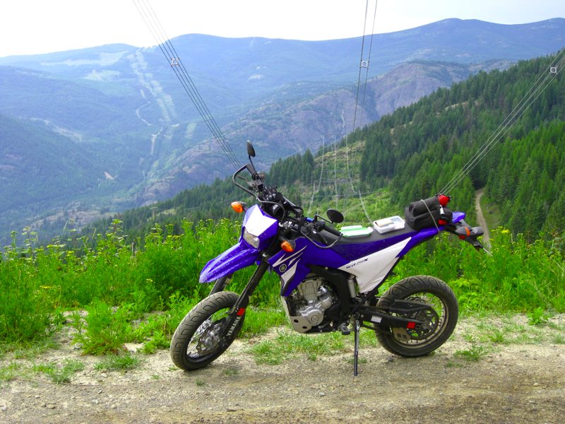
The Bikes: 2002 Yamaha XT225 and 2008 Yamaha WR250X.
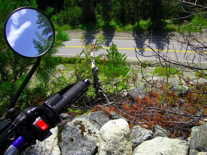
Having spent time pushing a fully armoured KLR through the drainage ditches of the deactivated B.C. Forest Service Roads, we thought it would be fun to try it with the little bikes. The WRX is a motard and Keith is running the Conti-force SM tires. They are soft, supple, and grip the pavement really well. We'll see about the dirt. Sharon is running street tires on her XT as well.
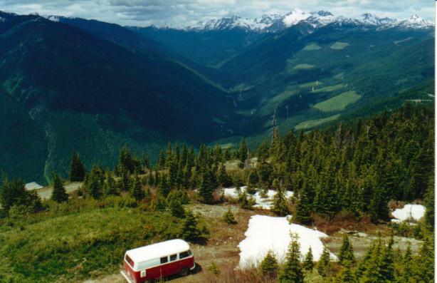
The Support Vehicle: 1963 Mercedes Umimog 404. This ex-Swiss Troop transport normally carries us and our camper to the remote back country. Using it to transport bikes will be a first for us. In fact having any sort of support vehicle is new to us, but by the time you pile all the camping gear onto the bikes, you're back up to the weight of the KLRs.
The Riding Gear: This trip will be a mix of highway and off-road so two full sets of gear will be packed in the Unimog. This consists of Textile road touring gear and helmets as well as full MX style gear, boots, and helmets.
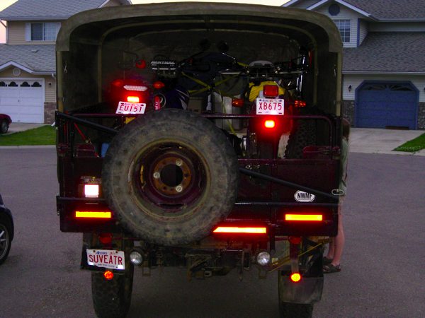
Packed and ready to go the night before.
Leaving Calgary at 6:30am after spending half an hour fueling the truck, we embarked on the anticipated 12 hour trip to Castlegar to attend the Kootenay Borscht, Burn, and BBQ (KBB for short) which is an annual event hosted by some good folks from http://www.sport-touring.net
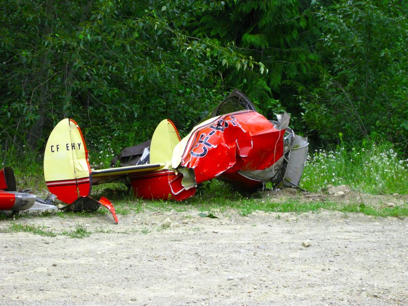
When we head to the Kootenays we like to head over Gray Creek Pass. This was fairly uneventful until we saw the remains of a plane crash that was being recovered from the mountain. It's a sobering reminder of the harshness of the terrain.

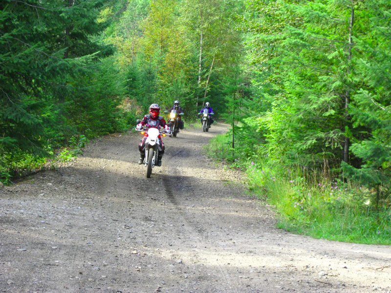
After 13 hours of travel due to missing a ferry, we arrive at the KBB. It seems we didn't take any pictures of the line-up of bikes at Bubba's house, so we've borrowed the above image from Kootenanny.
Breakfast the next morning at Gabe's in Castlegar was great.
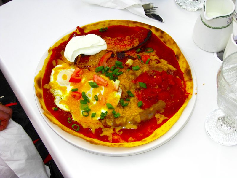
The huevos rancheros were really good.
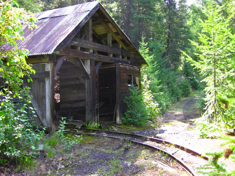
Due to a mix up of the groups on the KBB dual sport ride many people missed out on the breakfast, but that meant we got a personalized tour of the tunnels and trestles of the Kettle Valley Railway by STN's Bubba Zanetti.
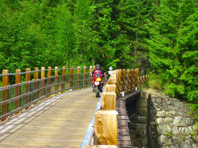
Sharon crossing the first trestle.
Sharon's XT with two KLRs in hot persuit.
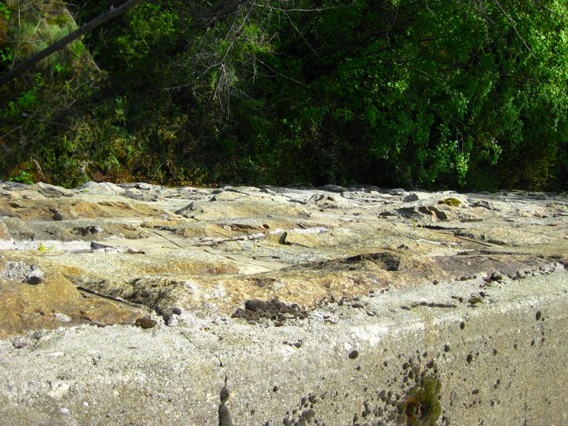
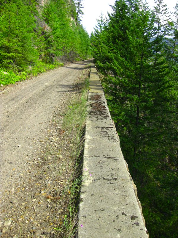
Many sections of the abandoned rail line are built on these huge stone retaining walls.
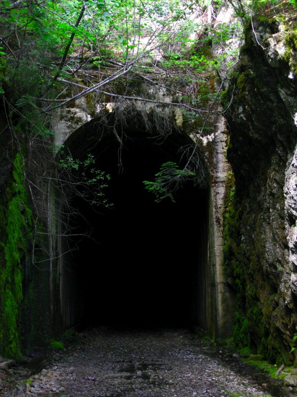
There are tunnels on the route which are large enough to fit a train (obviously) and somewhat eerie. One of the tunnels is very long and curved. There is no way to see the light at the other end. It is also wet and full of large round muddy rocks making for difficult riding. A dab or two was required.
Once we met up with the other STN'ers on the Dual Sport ride we headed through the old Cascade Highway which offers scenic views of the surrounding area.
Saturday night was spent visiting with folks at Alphabet-Man's cabin on the lake.
Sunday Morning after saying our goodbyes and finally getting all our stuff thrown into the Unimog we headed to a campground on the East side of Duncan Lake on the Duncan Forest Service Road near Duncan Dam.
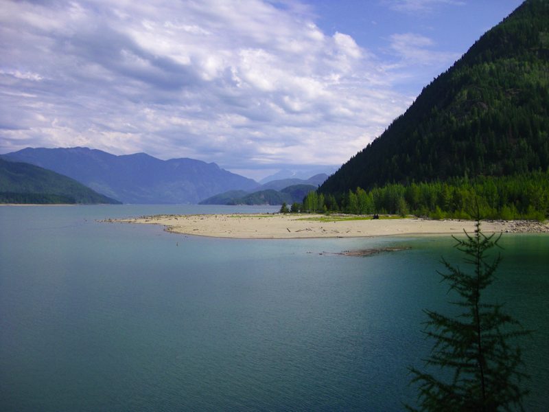
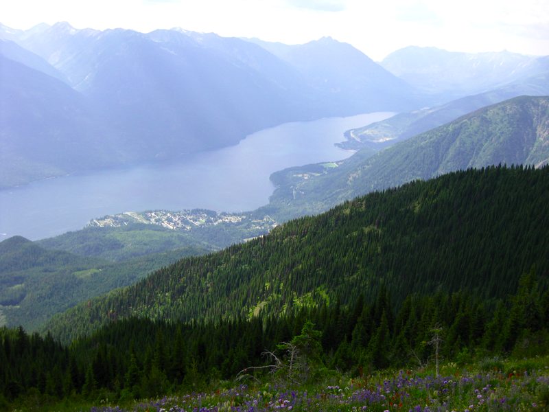
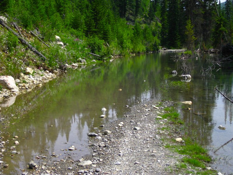
It's a popular spot with the locals for many reasons including the fishing on the lake, the spectacular views, and the access to the many Forest Service Roads (FSRs) that can be used for ATVs.
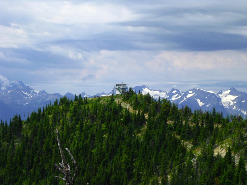
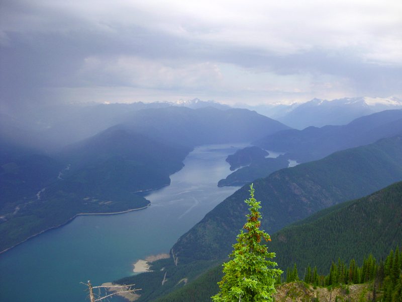
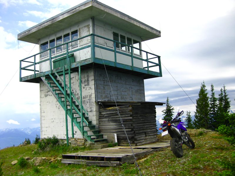
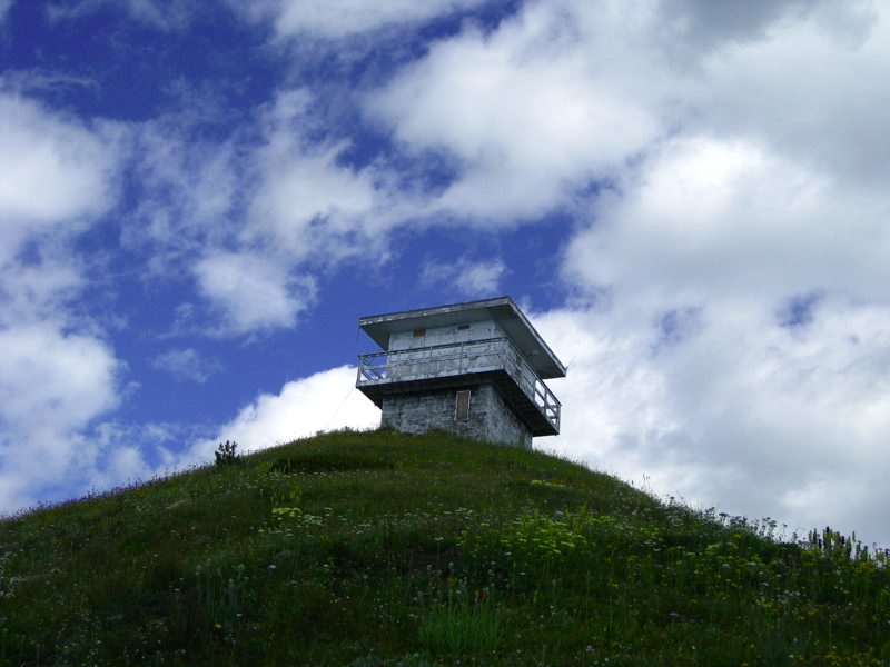
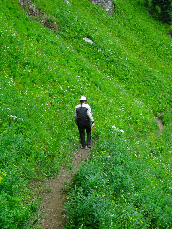
While we were there we decided to try to get up to the Mt. Lavina Lookout. We have been up there once before in the Unimog and it started to blizzard on us which made for an interesting trip down.
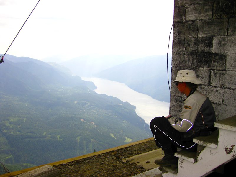
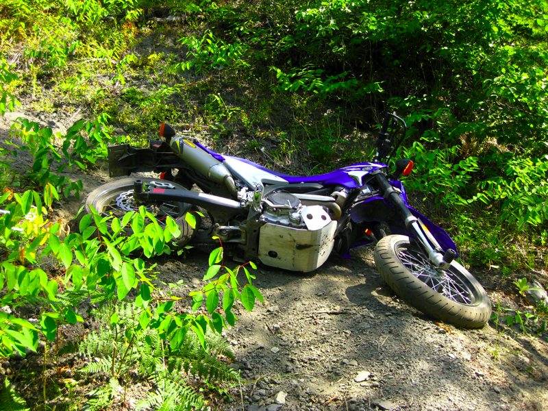
It was a very challenging trip on a motorcycle. Sharon couldn't make it the whole way and waited in a spot with a good view while Keith made a solo attempt at the summit. It was very difficult due to the steep slope and very loose rocks. We're not talking gravel but large, sharp, tire-cutting, rock. The stock WR250X gearing would not have been adequate. On one switchback Keith needed several attempts to make it. The key to getting the bike up seemed to be the same as running it on the motard track. Keep that momentum up and don't let off the throttle!
The interesting thing is that the smooth street tires were not the limiting factor. A knobby tire would have bitten in better, but it would have just thrown more rocks down the slope with no more forward momentum.
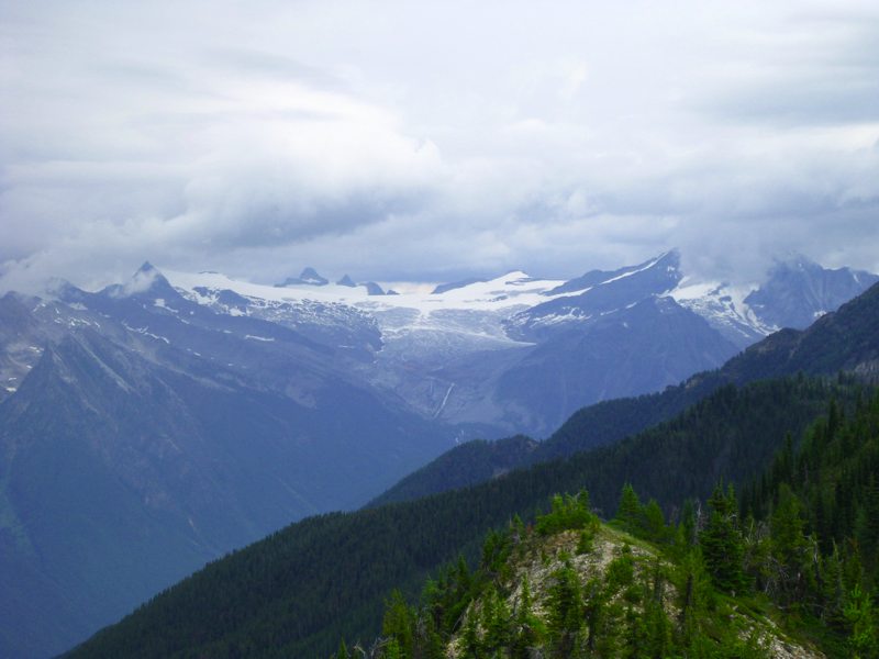
The views are spectacular and worth the effort. Unfortunately the road to the lookout is scheduled to be deactivated in September of 2009. On a BC FSR, deactivation does not mean closure. It means that culverts will be removed and replaced by drainage ditches and that the road will no longer be maintained, thus allowing Mother Nature to reclaim in her own time. For some roads that means years of fun for those who like a challenge to get to the scenery and have the equipment. In the case of the Mt. Lavina road it likely means that the road will be impassable within a year due to the steep grades and unforgiving terrain.
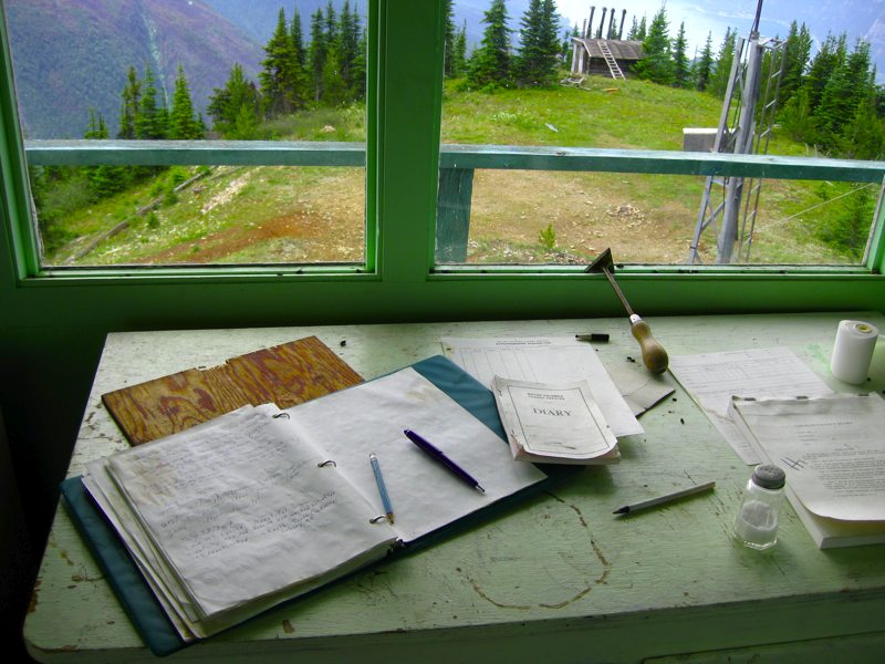
The lookout is now abandoned and the log book has been turned into a guest book.
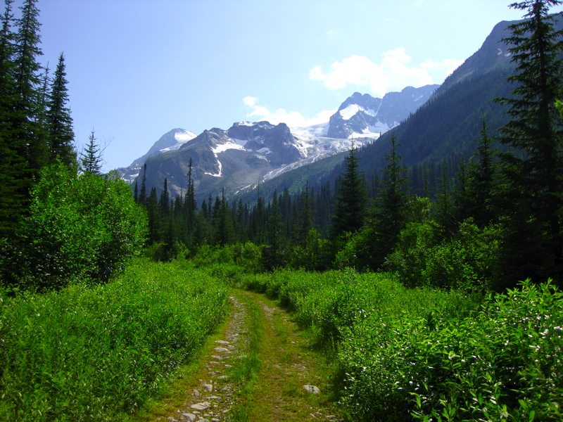
While we were in the area we headed to Jumbo Pass. There is a hiking trail which goes up to the Glacier as well as an ATV trail which goes a good ways in.
Here's the start of the ATV trail at the trail head.
We also decided to spend some time based out of New Denver so that we could explore parts of the area in more detail than we have before. In the Unimog we typically would go further into the back country, but the bikes provided a different perspective on the more local area.

Sandon is a ghost town along the 31A which we had never stopped at before. Much of it seemed like it's trying to be a little touristy and parts of it seem irrelevant historically to the area, however there were neat aspects like this steam engine.
Continuing through Sandon up to Idaho Peak we completed the trip with a hike to the lookout. Even the road to the trail head was interesting as there was snow and mud in some places.
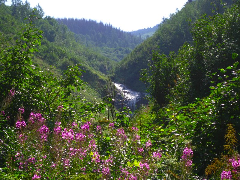
The wild flowers were going strong, as were the mosquitoes.
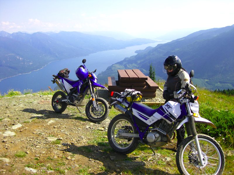
New Denver from the peak.
A quick rest at the top to admire the view before heading back down. Did we mention the mosquitoes?
Continuing with the railway theme of the trip we decided to try the old K&S Railway from Sandon to Three Forks (the turn-off to Sandon on the 31A) The old rail line is now maintained as a recreation trail. Like many such trails in the area it is intended to be used and shared by hikers, mountain bikes, ATVs, etc. Everyone we met on any of the trails were friendly and we showed the most extreme courtesy when meeting or passing someone.
The first part of it is a nice easy ride. Here is a section of the old rail coming out of an abandoned mine entrance. The entrance to it was not entirely collapsed and a foolhardy person could likely go explore it, but not us. Standing at the entrance you could feel a cool, damp, draft coming from it. It was very odd and quite a sight.
After a bit the quad trail disappeared and turned into what looked more like a hiking trail. It was decided that Sharon would go back to the Sandon turn off to wait while Keith attempted the trial on the WR250. A time period was specified before Sharon would start hiking the route to look for a stranded or upside down bike.
Parts of the route were very steep and very narrow with a ravine on one side. The marks shown above on the trail are from a mountain bike that went through previously, skidding down the hill. It was interesting that the street tires on the WRX, while only occasionally lacking for traction, disturbed the soil very, very, little.
Some sections of the trail were extremely tight and steep. Fortunately years of mountain biking skills came back as muscle memory. While most was ridable, some segments were so steep and so tight that the bike could not be ridden down the hills and had to be walked. This necessitated cutting the engine with it in gear and using the clutch as a rear hand brake and walking/sliding the bike down.
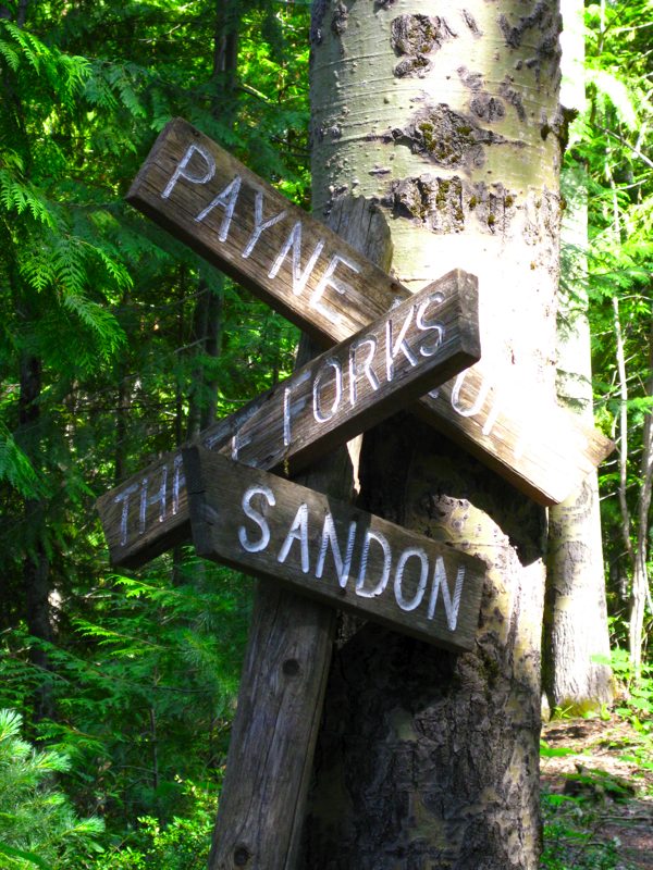
Finally arriving at the intersection pointing to either Payne's Bluff or Three Forks, Keith headed to Three Forks. Alas, the Payne's Bluff segment would have to wait for another day.
After the turn off to Three Forks things got really interesting. The descent turned out to be very tight switch backs that were too tight to turn even at full lock. This caused the discovery that the WRX can get tired, and does like to lay down occasionally. About six of these turns required the bike to be stopped in gear, the rear end picked up and hauled around.
How long can a 5.6 km rail bed take? Right?
At last Keith emerged onto Highway 31A, just past the Sandon turn off. The trail is almost invisible, but if a person looks for it there are three rocks stacked in the ditch to mark it.
As he emerged, there were two startled mountain bikers looking at the trail as though they were thinking of trying it. As if to respond to the looks on their faces Keith said: "Whew! That would be a tough trail even on a mountain bike!" and rode off to meet Sharon.
It was a tough trail, and would have been very technical even on a mountain bike. Stock WRX gearing would not likely have made it. It is unlikely that mere mortals could do that trail on anything much larger than a WR250 as even that was seeming big and heavy for the situation.
While in the area we also chose to do a loop of the actual highway 31, not 31A, past Meadow Creek and Trout Lake. Worth noting is that there is fuel at Cooper Creek at the Lardeau Valley Service station. The proprietor is enthusiastically living out his dream of keeping people from being stranded in the area with no fuel.
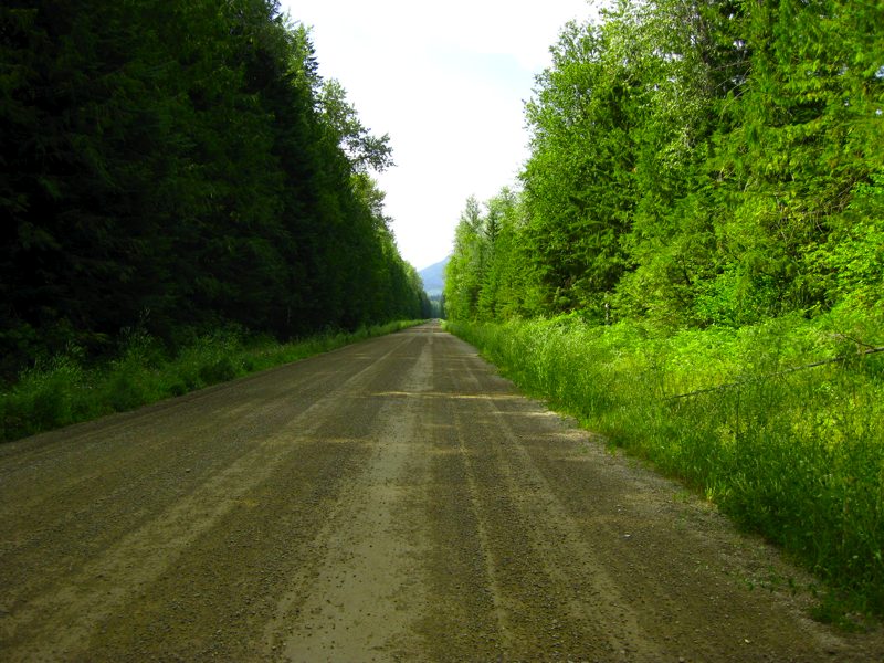
The first part of the 80km gravel portion past Meadow Creek is long, straight, and high speed. At Gerrard the road becomes really twisty as it goes past Trout Lake. A person needs to watch out for Logging trucks on week days.
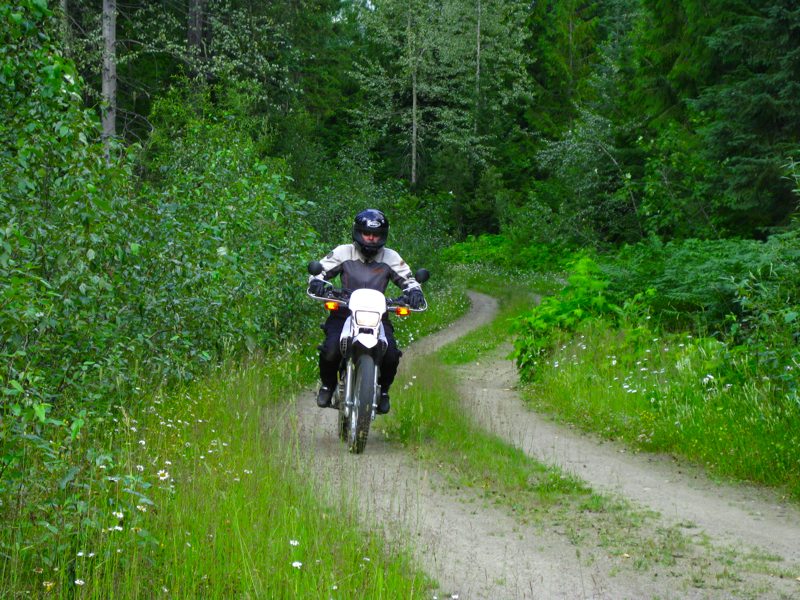
We even found a new 'short cut' from Meadow Creek to a point about 30km up the main road. Very entertaining route.
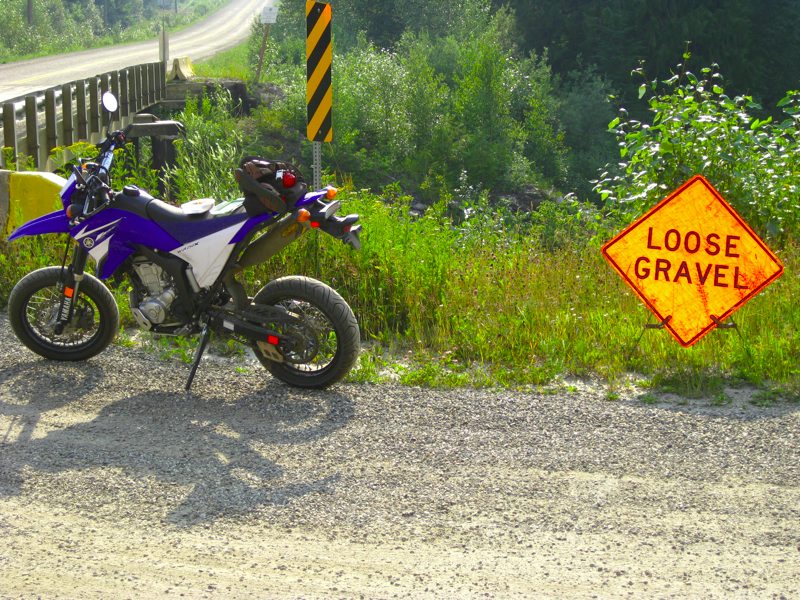
Apparently there is loose gravel on the road. Who'd have thunk it?
This picture also illustrates something else which we only observed much later. Somewhere along the Trout Lake portion there is an Alberta motorcycle license plate that used to be on the back of the WRX. Maybe if Alberta didn't insist on these HUGE motorcycle plates, they wouldn't keep vibrating to pieces?
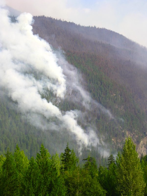
At the intersection of Hwy 31 and Hwy 23 there was a forest fire burning and helicopters carrying water.
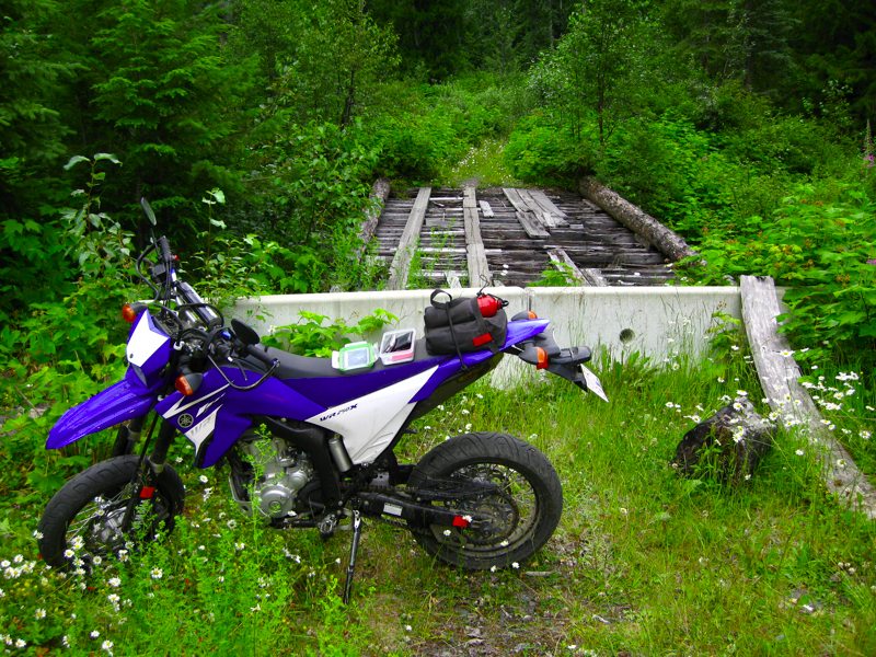
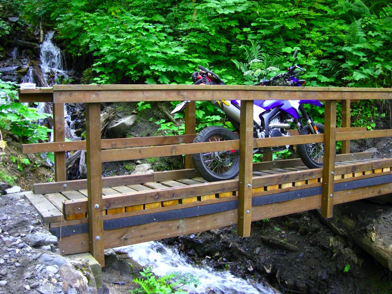
Bridges? We don't need much of a bridge riding a motard!
The Kane Creek FSR does extend a ways past the bridge. It is quite overgrown and finally ends in a land slide with about a dozen trees across the trail. That's OK though, since it's still a nice ride and view.
There are many other roads and trails. Many of them noteworthy and worth exploring over and over. This trip however we decided to keep to the theme of abandoned.

Overlooking Kaslo, the Buchanan Lookout offers spectacular views of the surrounding area.
The road up to it has been improved since we were there about a dozen years ago in our '65 microbus.
Unfortunately the interpretive center in the lookout is currently closed due to structural issues with the floor. It used to describe the history of the lookout and about how the usage, service, and supply to the lookouts has changed over the years.
Continuing with the abandoned railway theme there is also the K&S Wagon Road that used to run all the way from Kaslo to New Denver. Much of this has been restored and is maintained as a trail for hiking, mountain biking, ATVs, etc. It runs along side and above Hwy 31A for much of it offering interesting sight seeing opportunities.
The trip from New Denver to Kaslo takes about 45min by Unimog, closer to 30min by car, 20min at a reasonable speed on a sport bike. We think we now hold a record of 4.5hours from New Denver to Kaslo via all the portions of the Wagon Road that we could find. By the end of that day we had gone to Kaslo for lunch, up to the lookout, and back to New Denver for a total of 155km in 7.5hours of riding. At the end of the day Sharon said: "That's the hardest 155km I've ever ridden".
We can't wait to go back and do it again!
Finally the day came when it was time to head home. However, this being us, we had to take a detour along the way. There is a trail from Skookumchuck that heads around the White Swan Lake Provincial park and comes out on Hwy 95 past Radium. We had tried this twice before and not been successful due to too much snow early in the season. We felt this time might be the right time.
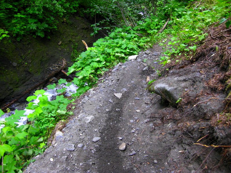
We headed off the highway at Skookumchuck towards Premier Lake Provincial Park, but kept heading straight along the road rather than down the spur to the park. A little after the pavement ends, at the beginning of a rocky ascent there is a "Road Closed" sign, but that just begs the question of "How Closed?"
After some rocky climbs came the "closed" portion.
We had already gone through some nice big puddles. How bad could it be?
This was the first of the 'Water' they were talking about. It was about axle deep, but still and had a smooth bottom so a person could hit it at speed, make big waves, and get through OK. The second one was as deep, but fast moving and had a rocky bottom which caused some soakers. A third water crossing and a large berm designed to close the road completed the trip out to the main road that leads south to Top of the World Provincial Park.
We rode north, around the east end of Whiteswan Lake & found the road north towards Kootenay National Park. About 1/2 way up this road we seem to have taken a wrong turn & ended up coming out to the highway at Canal Flats. 150km & 4.75 hours of riding later we were just 35km north of where we'd parked the truck. However, despite the fact that the northern part of the route will have to wait for yet another day, we enjoyed another great day of riding on some very nice dual-sport roads.
Summary and conclusion:
How the Equipment Worked Out:
Loading and unloading bikes from a Unimog is a pain. The deck is very high. The Unimog is also kind of slow on the highway if you're traveling in it for the sole purpose of getting to a destination.
The street tires worked out very well. There were only a few times where knobbies would have been better. We didn't have much rain so mud was kept to small stretches. The sticky tires were really nice on the pavement, but would be a bad choice for dirt roads with lots of rain (ie. lots of mud).
The XT225 suspension is definitely improved with a stiffer than stock rear spring and a couple of washers for front preload.
The WR250X has really good front suspension. If it wasn't for those beefy forks and some good Ohlins 5wt fork oil, the 17" front wheel would have been completely swallowed up several times. The rear WR shock does not offer enough damping to control the rebound off road and heats up very rapidly.
Things We Learned on Our Summer Holiday:
- Street tires can get you further than you might think off road.
- MX boots can save your feet.
- WR250X is a really capable bike.
- The 50lbs difference between the WRX and XT is significant.
- The difference between a 21" and 17" front wheel off road is significant.
- With a 1l fuel bottle, the little bikes have a 200km range which is adequate, but don't get lost.